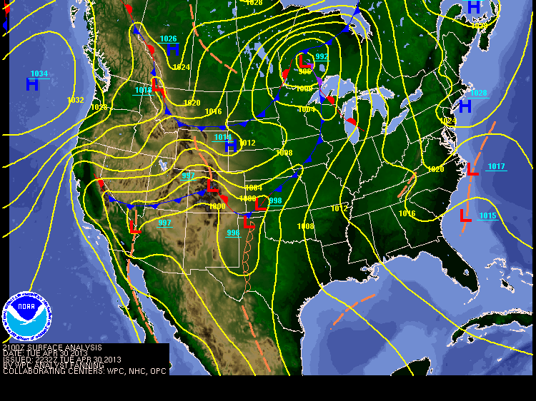
Beginning to analyze a cold front. Image saved on April 30th, 2013 (evening).
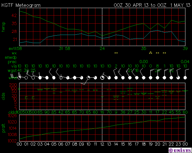
Airport in Great Falls, Montana. Status as of April 30th (evening).
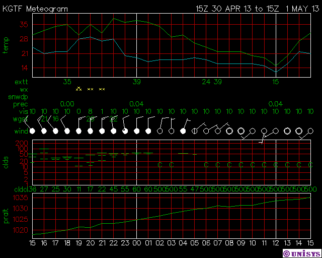
Airport in Great Falls, Montana. Status as of May 1st (morning).
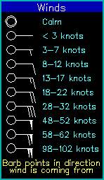
Winds legend
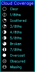
Cloud legend
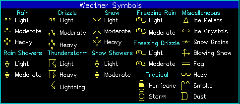
Weather legend
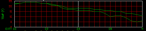
Temperature and dew-point chart
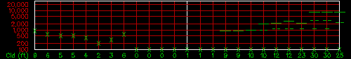
Cloud chart
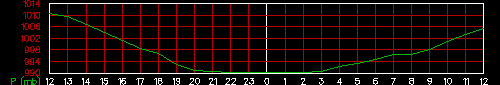
Pressure chart
From http://weather.unisys.com/surface/meteogram/sfc_met.php?inv=0&city=gtf®ion=nw (Unisys)
This is a 25-hour time series for a particular surface reporting station location. The data plotted include temperatures, winds, pressure, clouds and present weather. These data are updated hourly at around 50 minutes past the hour. The plot is divided up into several subplots described top to bottom:
Temperature and dewpoint chart - This shows temperature as the top line and dewpoint as the bottom line.
EXTT (extreme temperature) - The maximum and minimum temperatures are plotted below the chart at specific reporting times. 12Z and 18Z are generally low temperatures and 0Z and 6Z are high temperatures.
WX (present weather data) - This shows the weather being reported at that time as a weather symbol.
SNWDP (snow depth) - This shows forecasted snow fall in inches for the previous 12 hours. A value of 1 indicated anywhere from a Trace to 2 inches. A value of 2 indicates snowfall of 2 to 4 inches. A value of 4 indicates 4 to 6 inches and 6 means more than 6 inches.
PREC (precipitation) - This shows precipitation totals in inches. The values are 24 hour totals generally at 12Z, 6 hour totals at 0Z, 6Z and 18Z, 3 hour totals elsewhere.
VIS (visibility) - This shows the horizontal visibility in miles.
WIND (winds and cloud cover) - This is the standard wind and cloud cover symbols used in the surface data plots. Up is north.
Cloud chart - This chart gives cloud layer information. The vertical axis is height of cloud base in feet and is logarithmic. The layers are plotted as horizontal lines. Clear skies are plotted as a 'C'. Scattered cloud layers (1/8th to 3/8th coverage) are plotted as a single short dash. Broken cloud layers (4/8th to 7/8th coverage) are plotted as two short dashes. Overcast layers are plotted as a single long dash. The actual cloud ceiling is displayed below the chart in 100s of feet if the ceiling is below 10,000 feet.
Pressure chart - This chart plots sea level pressure (or altimeter setting if pressure not reported) in millibars. This may not be available for all sites.
Time - This is the reporting time in universal time.
Results and Reflection
- I believe the cold front passed at approximately 5 a.m. (UTC, "Coordinated Universal Time") on Tuesday, April 30th, 2013.
- The location of the airport I chose is Great Falls, Montana, U.S.A. (letter code KGTF).
- From my observations, the cold front passed over this area at 5 a.m. on the day above due to the fact that the top line (which depicts temperature) on the first-shown meteogram (from April 30th) and the bottom line (which shows the dew point) on the same meteogram--meet closely together during that time. "When the dew-point temperature and the atmospheric temperature are almost the same, it means that the relative humidity is close to 100 percent. It usually happens because the temperature sinks and the lower the temperature, the less moisture the air can contain. As it reaches saturation point, also known as, the dew-point temperature, moisture starts condensing on anything that has a mass. This is because, in order to condense, vapor must first get rid of heat energy, and it can only do it when transferring it to something with a mass, hence the dew you may see early in the morning when the temperature sank during the night" (Verheughe, Answers.Yahoo.com). This signifies that the cold front passing over would have resulted in an apparent temperature decrease, and clouds would have formed from the condensation of water vapor, creating an overall cooling effect (as clouds often do). Moreover, the winds at 5 a.m. were blowing at 8-12 knots, which later increased markedly, with an overcast sky. The wind direction continued to fluctuate all the way through the period when I collected the second meteogram, at about 3 p.m. Mountain Time on May 1st. By this time, the wind direction was southwest, which is another indicator of the passage of a cold front. In the very early morning of April 30th, the temperature was in the mid- to late-40s, but then dropped to about 24 degrees by noon, at which point, as stated above, the temperature and dew-point almost overlapped. Atmospheric pressure decreased little throughout both meteogram portrayals, but fog began to emerge on April 30th at 3 a.m., demonstrating the approaching cold front. High pressures (an anticyclone) are still coming about as a result of the cold front moving over Great Falls, with the atmospheric (barometric) pressure steadily increasing. Lately, during the night, mainly, according to Montana's time (which is also Mountain Time), the temperatures have fallen below 32 degrees, which are freezing temperatures. Some parts of Montana have been experiencing highs of 16 and lows of 7 as of yesterday, the 30th, but now that the cold front is dissipating, temperatures are rising. There are many bits of data to accumulate here.
- As a reflection on this assignment, I have realized that images pertaining to cold fronts are quite conducive to my learning. This relatively hands-on experience has assisted me in developing an understanding of the ways in which various fronts operate, and the many aspects involved in determining the times of fronts' passage, the qualities of the passage, the reasons behind the passage, and more. I am excited to continue comprehending more about these subjects, and value Meteorology as an effective tool for bringing about further interest in the subject, while applying this knowledge and information to my everyday life of living and thriving in this world we call Earth.
